Monday, October 13, 2008

Washington's Yosemite


Methow Valley Exploration 10/10/08-10/13/08

Normally, Michael and I take our vacation the week prior to Columbus Day. We load up the car and set out to explore the western US and Canada, but not this year. Instead we took a week to finish off the Wonderland Trail. So when my travel bug hit just as the calendar rolled from Sept to Oct we set off to explore a portion of Washington we had only driven through and always wanted to see more of - The Methow Valley.

Friends had been telling me for years the wonders of the Methow and I believed them. I just never got a chance to hike or ski or camp in this marvelous place. Michael was so excited to get going that the car was packed by the time I got home Friday night and we decided to drive all night until we reached Winthrop. Luckily, Pearrygin State Park was still open and we set up camp in the moonlight along the banks of the lake. Although we didn't get to sleep until well after 1am, I was up at sunrise to catch the 1st glimmer of the day on the lake.

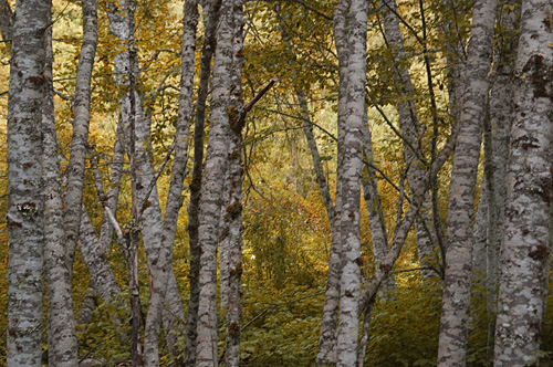
For the rest of the 3 day weekend, we drove along forest roads to scenic viewpoints and trails to be noted at a later date. We drove through stands of burned out trees from the 30-mile fire and stopped by the memorial honoring the fire fighters who tragically died fighting the blaze. We watched as hunters drove past looking for deer and then deer walk across the road as they passed. Above all, we admired the land of the Methow and Chewuch rivers.


Monday, October 06, 2008

On the Edge of Seasons


Beverly Creek/Tooth Saddle, 10/5/08, 9 miles, 2800 elevation

I was on the hunt for Larches, the oddity of the coniferous tree family. Their needles turn golden in the fall and are shed by winter and the trees seem to glisten on east slope hillsides shining brightly against the dark greens of the rest of the coniferous forest. I wanted to capture that quintessential image and although that image didn't materialize this trip (or this year) the hike up to Tooth Saddle will remain a highlight of this year's hiking season.

Snows had already fallen by the time our merry little band of Mountaineer hikers left for the Teanaway, but that wouldn't deter us from alpine views and autumn color. The trail along Beverly Creek is an easy saunter slowly gaining altitude through forest and talus fields. Autumn leaves filtered the sunlight to a ruddy glow on the occasion it made an appearance from behind the clouds. We stopped for a short break before climbing to the ridge and joining the County Line trail for a wonderful traverse with views of the Enchantments across the valley.

Along the way to our next climb, pockets of snow still lingered amongst the shrubs and fallen logs. But the sky by now had cleared to shine blue on the mountains surrounding the valley. Here also we found our first larches, some a greenish gold, a few a dazzling gold. Soon we were up in the saddle just below the tooth and watching as dark clouds rolled over the Enchantments bringing with them flurries that fluttered all around us. As soon as the snow brushed us the flurries were gone and we made our final push up to Tooth Saddle.

We were heavily rewarded by sparkling views all around but it was the Enchantments and their crown Mt Stuart that snatched our breathe. Well, maybe it was also the bitter wind blowing through the saddle. Our larch hunt may not have been very fruitful, our quest for views bountifully rewarding.


Monday, September 29, 2008

National Public Lands Day


Mt Pilchuck Work Party, 9/27/08

As Discover Your Northwest, the organization I work for, expands and tries on new hats we come across opportunities too good to pass up. One such opportunity is partnering with the Mt Baker-Snoqualmie National Forest to develop a series of volunteer events in needful areas. Not necessarily trail maintenance and repair (as this past weekend's was) but eradicating invasive plant species, building picnic tables and birdhouses, or anything else the forest finds a need to do. We affectionately call the series of events Earth Day Every Day.

This weekend, we sponsored an event at Mt Pilchuck to repair some trail damage. A portion of the trail has been the drainage of melting snows and hikers trying to avoid getting their made-for-the-mud expensive boots dirty have walked around making new trails. This can get me onto a soapbox, but I'll spare you from that at the moment.

Our workday, was a blast! We lopped brush from the trails around the picnic area. Did you know Mt Pilchuck has a picnic area - just off to the right at the start of the trail - check it out. We moved rocks along the muddiest parts of the trail for stepping stones. We applied erosion control matting and posted signs to warn hikers that this was a habitat rehabilitation area. Two of us gathered seeds to germinate in the greenhouse for transplanting later. It was a good day and we all left the trail feeling good about all the work we had accomplished.

For more information on volunteer events visit the Discover Your Northwest website at http://www.discovernw.org/get_involved.htm

What not to do with the Stomach Flu

Aspen Grove

Cascade River Rd, 9/20/08, 6 miles, 1500 elevation

There I was, in the midst of low-lying clouds and autumn colors, hunched over my arms holding my stomach as if I hugged harder I could hold the few contents of my stomach in place. "Oh please, not here" I thought. I couldn't imagine coming across someone else's sick along a trail (or in this case roadside) while hiking and had no desire to subject anyone to mine. And it was a matter of pride. I had been wanting to hike to Cascade Pass for several years and here was my opportunity. I was NOT going to let a little thing like a frail body subjected to a stomach bug ruin my outing. Plus this was to be my graduation hike for the Mountaineers' Conditioning Hike Series.

I had been dealing with my stomach bug for 2 weeks prior to the hike, which I kept reminding my sick stomach was scheduled long before it felt ill. But on Friday I was feeling better - maybe not 100% but better and looked forward to this fabled journey to Cascade Pass and Sahale Arm. We got to the rendezvous point to meet the rest of the group and found out that the road had been closed 3 miles from the trailhead, so our hike would not reach Sahale Arm but would be able to make Cascade Pass. Either that or we could hike another trail in the area. As the clouds drifted through the valley, we decided to do the road walk then continue up to Cascade Pass and decide from there to go on or turn back.

Autumn was just touching the leaves of the forest as our group started up the Cascade River Road. The clouds hanging low on the hillsides. I had warned our leader that I would taking it slow, but even I was surprised how leaden my feet were. Sweat was dripping off my brow at our first break and we hadn't even started climbing yet. At a mile and a half the stomach cramps started and my feet were more sluggish - I was constantly wiping the sweat off my face. By mile 2, I knew what Michael had known an half mile back, I was finished. Both he and the leader agreed to allow me to continue at least to the actual trailhead to discuss our carpooling options before heading back down the hill.

By mile 2 1/2 I was doubled over praying I could make to the pit-toilet at the trailhead. I finally met up with Michael, who hurried ahead to talk to the group, and the rest of our companions and apologized for being so slow. After hugs and goodbyes all around, Michael and I watched as the group disappeared into the trees and clouds. I did stop by the toitie, but luckily my sickness urges had subsided. Michael grabbed my cold hand and we walked side-by-side back to our car.

On the way down, I began to notice the colors in the growth next to the road and the spiderwebs strung with dew. I was disappointed that I had to turn back on this trip, but relieved that at least I had Michael to walk home with.


Sparkles

Monday, September 15, 2008

3 Days for Boobs

EV-083D-720

Susan G Komen Breast Cancer 3-Day.

For the last couple of years, I have followed my sister on her journey to try and end breast cancer. Her journey involves walking 60 miles over 3 days in the Seattle area, raising funds to go towards research an prevention of this devastating disease.

I usually follow her and her teammates around with my camera recording their efforts, their joys, their pains and feel somewhat touched by the event and those who dedicate so much to it's cause. This year I joined the crew as the photographer, to create images of the event that may be used in future marketing materials. It was 3 long days of exhaustive work, something I would do again if given the opportunity.

And for any who would like to help with the eradication of breast cancer, please check out events and opportunities during Breast Cancer awareness month of October.

Monday, September 01, 2008

Westside, Part V


Wonderland Trail, 8/26-30, 32 miles

Maybe we should have called this the "wetside" of the Wonderland. After several years of failed attempts on the westside of Rainier, we finally made it to Lake Mowich. Two years ago, we trekked from Longmire to Klapatche Park. Our plan had been to go all the way to Lake Mowich, but were chased off the mountain by snow still lingering in the trees and clinging on the slopes. Last year we were thwarted by the floods the winter before. So this year we planned to head up the Westside Road and hike into Klapatche Park from there to continue along our northward route.

Because of continued road repair, our trip started in the Glacier View Wilderness outside the park. It was a beautiful day as we made our way past Goat Lake and over Gobbler's Knob to Lake George. Amazingly, we were the only campers at the lake so we decided to take over the shelter and a good thing too. The weather began to turn and before the sun was completely down it started raining. It continued to rain off and on for the next 3 days. We were soaked, our gear was soaked, and our mood was soggy. I remembered stories from a friend who had attempted to hike the Wonderland but hiked out after he opened a ramen package and it was already wet.

As the rains settled in the 4th night, and after talking to the ranger who informed us that the freezing level would be dropping over the weekend, Michael & I came to the decision to call my sister for a pick-up at Lake Mowich. We had hoped to hike over to the Carbon River and back in a loop on days 6 & 7, but the fact that I was already sleeping in the emergency blanket in side the sleeping bag made it clear that wee should have come prepared for winter camping instead.

But that's not to say it was all misery. A break in the rain at Klapatche Park let us wander around the flower garden around Aurora Lake. We spotted moving white dots on the cliff face over the North Puyallup River and surmised they were Mountain Goats. During a patch of sun, I stepped over a fresh pile of purple bear poo only to have Michael stop me dead in my tracks by saying "Bear! On your right." She was just 30 feet away grazing on the plentiful berries and paying us no mind. And the relief as we finally gazed at Lake Mowich knowing we had finished our task.

And then there was this hill . . .


Tatoosh Lakes, 8/24/08, 5 miles, 2700 elevation

This may sound blasphemous to some, but sometimes I really don't like Ira Spring or Harvey Manning (God rest their souls). These two icons of northwest hiking wrote the book on writing hiking guides and luckily there are a few hiking guide authors who have thrown away that book. Short and/or flat hikes were generally ignored by this writing team as were realistic descriptions and hiking times. In a nutshell, here is the description for Tatoosh Peak out of "100 Hikes in the South Cascades and Olympics": rapidly climb a hill, star walking through meadows, climb 3 short switchbacks, and easily follow the trail to the peak and beautiful views. Oh come on! By the time we got past the 3 short switchbacks even the dog was tired - so much so that she missed the deer standing in the meadow 100 feet away!

With our big backpacking trip just days away, Michael & I figured we could do a little warm-up hike to Tatoosh. I had wanted to do this hike the week before, but with the heat that struck us that week and my reaction to it, we decided to postpone this hike and rest in some A/C on my birthday. Add were we glad we waited. Even with cloud cover and cooler temps, it didn't take long before sweat was dripping of the both of us.

We climbed steeply through the forest along 15 switchbacks and met a pair of llamas along the way. Zillah was immediately intrigued by these strange creatures but didn't bark or growl. We felt like such proud parents as we watched the llamas pass and we continued uphill. As we finished the switchbacks we hoped for a little break in the climb but got no such reward - the hill was unrelenting. The flower-filled meadows came into view and still we climbed. The 3 short switchbacks were short and sweet and gave Zillah her 1st chance at water (we crossed a stream all 3 times). We stopped for a rest while the deer looked down at us, Zillah obliviously panting at our feet.

As we finally reached the junction with Tatoosh Lakes, we decided that the storm that had been brewing all morning would likely hit us while we took in the views from Tatoosh Peak. Michael, having grown up in Colorado, has an aversion to being on mountaintops when storms roll in and my thigh muscles were screaming. So we cut the trip short by heading over the hill to the lakes and rested a bit there with Mt Rainier watching over us.

My description of the trail? Tough climb through the woods and meadows, but worth every step to get those views and to see the abundant flowers. You might even get to see something new along the way.