Showing posts with label North Cascades. Show all posts

Monday, September 01, 2014

Transitions


It's still summer here in the Pacific Northwest. The days are filled with sun and warmth - the thought of grey days still far from our minds. We're out hiking, camping, boating and generally enjoying the season. The leaves are still green. The flowers are still blooming. And there's a sense that it will never end.

But sadly, summer has to end.

It always does.

The evidence is out there if you know where to look for it.

The transition starts high where the summer season is shortest. 

At 5400 feet, summer is short lived at Cascade Pass in the North Cascades National Park Complex. Just a couple of months ago there was snow on the alpine meadows here. And now, during the Labor Day weekend the Gentian is blooming - the flower that herald's the coming of fall.

And yet, as the wildflowers die off or go to seed the color has not left the meadows.

The leaves of the False Hellebore have started to yellow, a tarnished gold on the tips yellowing to green. An eye-catching color as you hike past. It's enough to draw your eye away from the alpine scenery, look down and marvel at nature's beauty.

Shifting seasonal color can also be found lower in the forest below the pass. Lady ferns turning brown against the still green leaves of devil's club and starry false solomon's seal whisper the transition from summer to fall.

All too soon the meadows will be filled with the reddened blueberry bushes with the 1st kiss of frost on their leaves. I love this transitional period and savor the colors of nature as they turn from flowers and greenery to the warm burnished colors of fall.

I encourage you too to go out and play in nature as it welcomes fall.


Tuesday, July 08, 2014

Heidi's Hotspots: North Cascades National Park Complex: Cascade River Road


So much of the North Cascades National Park Complex is only accessible by trail. Even though the beautiful interior of the park takes a desire to strap a pack onto your pack for several hours (or days), our "American Alps" are worth the effort. But if you're not ready for the hike, let me tell you about one of my favorite spots for photography that is not much effort at all - the Cascade River Road.

This 23 mile road leaves from the North Cascades Highway (Highway 20) and follows the Cascade River to a basin of jagged peaks and glaciers. Along the way you'll pass wild-life areas, forest glades, waterfalls and have I mentioned mountain views. This is a road that has it all.

To get there, drive east on Highway 20 from Burlington to Marblemount. In Marblemount, the highway takes a hard left turn, but you will continue straight to cross the bridge over the Skagit River. Just after the bridge is a wildlife area - a perfect place to stop and watch bald eagles in the winter. Bald eagles love the Skagit River, converging on this salmon spawning thoroughfare for an easy dinner (breakfast and lunch too). Drive a little further to the fish hatchery for more birds (herons and eagles licking their beaks at the fish swimming deliciously in tanks. The fish are protected by netting above the tanks.

As you drive further along the road, you'll pass a few trailheads for some nice steep trails and a couple of National Forest campgrounds. The campgrounds are nice places to set up base camp if you want to explore the trails or the road more. You'll also pass through lots of moss-draped forest. Moisture from the west hits the mountains and dumps rain into the area, making for perfect mossy habitat.


The road begins to climb steadily and as you drive, you will begin crossing streams, look uphill for the waterfalls. They shouldn't be too hard to find as they are right next to the road. Most of the falls and streams have pull-outs near enough for you to park and walk back to the views with whatever gear you might need.

At about 13 miles, you'll cross the National Park boundary and the road will really start to climb - at times extremely steeply. (Who built this road? Mountain Goats?) The road also narrows quite a bit so stopping is more limited, but there are a few places to pull off so you can photograph wildflowers and more waterfalls and a few mountain views. Another option is to park your car in one of the parking spots along the road, or at the end of the road and walk back and forth. This road can be busy during summer weekends so be EXTREMELY careful. On the shoulder seasons, spring and fall, the gate can be locked so walking the road will be your only option.

The road ends at 23 miles in. Try to keep your eyes on the road as you make the final push. It will be hard. The peaks and glaciers will demand your attention. The end of the road is also the trailhead for the Cascade Pass Trail. The most popular trail in the park and again, steep. Well worth the effort if you're in condition to attempt climbing 2000 feet in 3.5 miles. If you're not, the bowl you are now parked in will give you plenty to focus on. Don't forget to look down once in a while for wildflowers and marmots.

And just enjoy the beauty.

Monday, September 29, 2008

What not to do with the Stomach Flu

Aspen Grove

Cascade River Rd, 9/20/08, 6 miles, 1500 elevation

There I was, in the midst of low-lying clouds and autumn colors, hunched over my arms holding my stomach as if I hugged harder I could hold the few contents of my stomach in place. "Oh please, not here" I thought. I couldn't imagine coming across someone else's sick along a trail (or in this case roadside) while hiking and had no desire to subject anyone to mine. And it was a matter of pride. I had been wanting to hike to Cascade Pass for several years and here was my opportunity. I was NOT going to let a little thing like a frail body subjected to a stomach bug ruin my outing. Plus this was to be my graduation hike for the Mountaineers' Conditioning Hike Series.

I had been dealing with my stomach bug for 2 weeks prior to the hike, which I kept reminding my sick stomach was scheduled long before it felt ill. But on Friday I was feeling better - maybe not 100% but better and looked forward to this fabled journey to Cascade Pass and Sahale Arm. We got to the rendezvous point to meet the rest of the group and found out that the road had been closed 3 miles from the trailhead, so our hike would not reach Sahale Arm but would be able to make Cascade Pass. Either that or we could hike another trail in the area. As the clouds drifted through the valley, we decided to do the road walk then continue up to Cascade Pass and decide from there to go on or turn back.

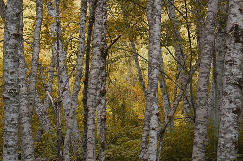
Autumn was just touching the leaves of the forest as our group started up the Cascade River Road. The clouds hanging low on the hillsides. I had warned our leader that I would taking it slow, but even I was surprised how leaden my feet were. Sweat was dripping off my brow at our first break and we hadn't even started climbing yet. At a mile and a half the stomach cramps started and my feet were more sluggish - I was constantly wiping the sweat off my face. By mile 2, I knew what Michael had known an half mile back, I was finished. Both he and the leader agreed to allow me to continue at least to the actual trailhead to discuss our carpooling options before heading back down the hill.

By mile 2 1/2 I was doubled over praying I could make to the pit-toilet at the trailhead. I finally met up with Michael, who hurried ahead to talk to the group, and the rest of our companions and apologized for being so slow. After hugs and goodbyes all around, Michael and I watched as the group disappeared into the trees and clouds. I did stop by the toitie, but luckily my sickness urges had subsided. Michael grabbed my cold hand and we walked side-by-side back to our car.

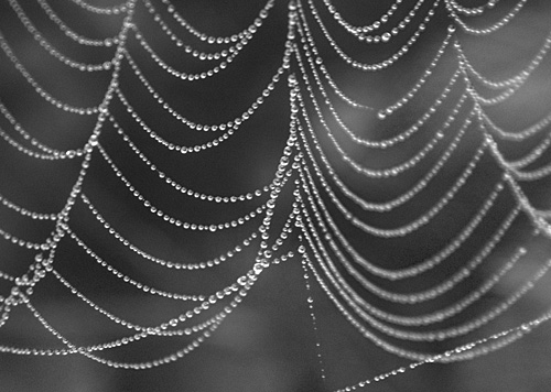
On the way down, I began to notice the colors in the growth next to the road and the spiderwebs strung with dew. I was disappointed that I had to turn back on this trip, but relieved that at least I had Michael to walk home with.


Sparkles

Monday, June 18, 2007

Perpetual Motion


Plan A fell through for the weekend, as did plan B, plan C and a few subsequent plans after that. But our adventurous spirits would not be squelched, so we packed up the puppies and drove north. Our 1st roadtrip right after we 1st met was along the cascades loop. Head north on I-5 to highway 20, turn east up over the mountains through the North Cascades National Park, when you reach the eastside head south on highway 97 until you get to Wenatchee where you turn west and head back over the mountains through Stevens Pass. We left late so weren't able to stop too often - our agenda was to continue on until we made it home again.


The snow is still melting from the high country - in fact snow still lingered along the highway at Rainy and Washington Passes obscuring the meadows that in a few weeks would be alive with flowers and critters. The run-off cascaded down the hills at every turn. Large vertigo inducing falls across the valleys to the small trickles running through the rocks at road side. They blurred by us as we sped along the highway. I wanted to get out and photograph every one I saw, but we had so many miles to go.


We finally stopped in Winthrop for dinner. Sitting on the deck of the restaurant, I sat mesmerized at the cottonwood tree on the river bank. The wind blowing down the river flipped and flickered the leaves of the cottonwood in an hypnotic dance.


All too soon, we were back on the road. With necessary breaks and dinner, we made it home 12 hours after leaving. Too bad we couldn't stop for real sight-seeing.