Showing posts with label Conditioning Hike Series. Show all posts

Sunday, April 15, 2012

Cowiche Canyon


When you live on the wet side of the mountains like I do and go through a cold wet winter like we did, the dream of spring comes with the 1st day of March. And so it was that I sat daydreaming out a rain soaked window wishing for sunny skies & wildflowers when my partner in hiking emailed that she would love to have me co-lead a Conditioning Hike in Cowiche Canyon. I of course said "Well, Heck Yeah!" Cowiche Canyon is near Yakima - on the sunny dry side of the state & we can usually find wildflowers aplenty in March.

However, when it came time for our hike my friend showed up sick and begged me to take over for her. Well, that is why I was there - as her backup plan. We left her behind & drove through showers & snow to arrive in Yakima to partly cloudy skies. Oh Hallelujah! Just what I had been daydreaming of, now if only we'd find the flowers too.

We started off in the canyon marveling at the columnar basalt and lichens, crossing over Cowiche Creek several times. A few flowers were blooming. We made it to bridge 8 and started our climb out of the canyon along the uplands trail. And sure enough, we were soon greeted by Yellow Bells, Grass Widows, Prairie Violets and other small lovelies.

Lunch was eaten on an outcrop overlooking the canyon & out of the wind. Then we crossed back over bridge 8 to climb the vineyard trail to the wine tasting room on the other side of the canyon. In the rocks as we hiked Yellow-Bellied Marmots played. It was with some regret when it was time to head home - the sun was so warm & lovely on our faces.

Monday, April 12, 2010

Looking for a Sign


Cowiche Mountain, 4/11/10, 6 miles, 1100 elevation

Sometimes it's a good idea to scout out an unfamiliar trail prior to leading a group of hikers into the vast wilderness. Never mind that my good friend told me that following the trail would be no problem as it is well signed. Ignore the fact that we were hiking in the steppe plateau near Yakima. Who can get lost? Me, it seems.

All seemed to start out all right. We found our way to the trailhead, but things began to go wrong almost from the start. The well-signed trail was not as well-signed as I would have hoped. We came to a junction and the only sign I saw was to the left so we followed that sign. We did get to see a Barred Owl high in a tree as we walked and a little later a coyote running through the scrub.

But we noticed a problem as we came to another junction - there were no signs. The trail heading left petered out as it reached the brush - the trail right was wide and looked well traveled. However, 1/4 mile into it this trail also disappeared. We backtracked but could not find where we lost the trail. The mountain top could be seen in the distance so we started cutting through the sage cross country, oblivious to private property.

At some point, while reading the terrain, we spotted other hikers coming down the mountain. A decision was made to head in their direction and hopefully pick up the trail from there. Sure enough, after crossing one last ravine and traversing the mountainside a while, we came across the trail with cairns and signs.

The wind picked up as we ate lunch and soon we were heading back down the hill on the same trail. I had to find out where we lost our way. Approaching one gated fence, we found a sign handily placed behind a bush. Soon we came to the junction with the wide trail and the petered out trail. Sure enough, the trail that "disappeared" was the trail we should have followed, yet there were no signs pointing the way. Finally coming to the 1st junction, we spotted another sign in the direction we should have followed.

But what is adventure without a little exploration?


The Grey Wolf


Lower Grey Wolf River, 4/10/10, 7 miles, 600 elevation

I have always had a pull to the Olympic Peninsula. Ever since I was a child, my family's vacations in the rich dark forests were looked upon by me as an escape from everything that troubled a young child's mind. So when the opportunity to change the destination of our CHS hike because of poor scheduling on our part (note to self: read the tide tables PRIOR to scheduling the trip), I jumped at the chance to explore an area I had not yet explored - the Grey Wolf River.

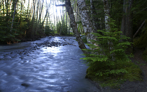
Deep in the Buckhorn Wilderness flows the Grey Wolf River, not well known but no less beautiful than the more well known rivers of the Olympic peninsula. Protected by the thick forest in the rainshadow of the Olympics rushes over rocks and meanders around thick bends. In the spring, runoff from melting snows up high swells the waters to a raucous noise. But as we were hiking early in a late snow year, the river was a quiet companion whispering of its journey to the sea.

The trail is generally flat with a few hills to climb over but always the moss and fern covered forest floor awaits you as you descend back to the river's side. Sun sparkled through the heavy trees and you wonder with the thickness of moss, ferns and tree if this is truly a rainshadow forest. In comparison to the rainforests of the Hoh & Quinault there can be no doubt. Yet a comparison to even forests along the western Cascades, the lush life belies the thought.

We stopped at river's edge for lunch just prior to the washout before turning back towards home. And the life of the Olympics still thrives in my soul.

Friday, April 09, 2010

April Snows bring . . . ?

Big Creek Loop, 4/3/10, 4.5 miles, 600 elevation

Our plans were made in February - an unseasonably warm February where we hiked trails normally closed until April or May. Our excitement in getting to destinations early in the season was uncontained as we planned the hikes for this year's Conditioning Hike Series. Even so, Big Creek Loop is hikable in the early season - one of the reasons I enjoy the hike on the SE side of the Olympic Peninsula. The forest is filled with the new green of spring. But not this year. No, this year brought us snow - a lot of it.
Our merry little group started out at the Big Creek campground in a spotty dusting of snow, telling stories and getting to know each other, stopping to identify fox prints in the snow. A slight rain began to fall on us as we started our climb through the trees. It wasn't long before the rain showers turned into snow showers. Soon, it was just plain snowing and accumulating on the trail, ferns & trees.

Knowing I had a few newer hikers on the trip, I asked if anyone was uncomfortable. There waas still time to turn back, but this being a loop everyone opted to continue on. One of the features I love about this trail is that there are several different streams to cross as well as Big Creek. Big Creek is at the apex of the climb then the trail follows the other side of the drainage back down to the campground. By the time we crossed the bridge over Big Creek, we were hiking through 8 inches of snow - almost perfect for snowshoes.

I had hoped for lunch at a little bench tucked in the trees next to the creek. But the snow wasn't relenting so we traveled a little further until I could not postpone lunch any longer - my hikers needed to eat. So we huddled together under Alder swaying with the wind. Adding insult to injury, the wind knocked chunks of snow off the trees with well-aimed precision, splattering on our heads and down our jackets.

Soon we were down to the land of rain showers and a dusting of snow - ready to see what the rest of the season brings us.

Monday, August 24, 2009

A Grand Hike


Grand Ridge/Grand Valley, 8/22/09, 12 miles, 2500 elevation

Starting from Obstruction Point in the Olympics can make for a long day, but the trails leading from the end of the road there are marvelous to behold. And when you link several together in a large loop, you come away with a very satisfying hike. I've been wanting to share this special place with others and my opportunity came when we began looking at hikes for the Mountaineers' Conditioning Hike Series.

I was first introduced to this area many years ago by my sister. She was intrigued with this road that our family always seemed to avoid when we were children. After our steep descent on the road, we understood. Mother was afraid of heights, and to get out to the trails the road wound along some very steep cliffs. At least they would have seemed that way to her. We found a loop on the map and decided that Badger Valley to Grand Lake and over Grand Ridge would be a wonderful way to spend the day. So we toughed out the road, toughed out the trail, and toughed out the drive. In the end we were both taken by the beauty and it became one of our favorites.

I later did sections of the trip with Michael. He too became so enamored with the area that a fifteen hour day to get there and back was never questioned. We had met one of the biggest marmots ever while hiking these trails along with exquisite flower displays. (No wonder the marmot was so huge.) But we would run into several obstacles when thinking who we could introduce this trail to - not the least of which was the difficulty of the primitive trail from Elk Mountain to Badger Valley. Finally, we decided to give the CHS class a chance. Students jumped at the opportunity.

To start off on our route, we had to traverse what is called the head-wall along a narrow path of flattened talus. We took it slow to make sure our hikers had their feet under them. But the hesitation some felt gave way to delight as we crested the ridge to views of Mt Baker, Vancouver Island and the Strait of Juan de Fuca. We would have stayed on the ridge a little longer, however autumn was felt in the wind and we again took refuge on the trail behind the ridge. Not long after we met up with a fat-butt marmot walking on our trail. He stopped to pose a while then waddled off the trail to let us pass.

The way down to Badger Meadows from here is along an almost abandoned primitive trail - no longer maintained by the park, just the few dozen hiking boots that dare follow the little dotted line on the map. This was the section that made Michael & I hesitate about bringing others with us. The way is full of loose rock and dirt, steep inclines and frightening drop-offs. Everyone seemed ready if not a little reticent, so with Michael in the rear to help anyone along and to chat with them to keep their minds off what they were walking on, we slowly started downward. It took us longer than I expected but we kept the pace slow and I would coach people down the rougher spots as Michael offered reassuring words from behind. And soon we were walking through the meadows that in July are filled with flowers and marmots. Some of our hikers were ecstatic - they would never have thought they could have hiked a trail as forgotten as that one. And yet they did - smiles were shared all around.

We stopped in a wide meadow surrounded by mountains for lunch. We ate as we gazed upward at these mighty structures. The Olympics may not be as grand as the Sierras or the Rockies, but they never seem to fail to impress. A little more downhill and we were on our way to climbing up along Grand Creek to the lake. The afternoon was moving along to the sounds of laughter as we shared stories on the lake shore. One of our members even decided a swim would be just the thing before climbing out of the valley. And a climb it was going to be.

My first hike with Kristi left us both sweaty, exhausted and defeated. So much so that we vowed to make our impression on the "mountain" as soon as we reached the top. Our impression was in the form of posing victoriously topless. We made no such vows this time except what we'd be ordering at the Mexican restaurant when we got to town. A slow and steady climb got us to the top and along the ridge to the parking lot. Along the way are views of the interior of the the park and Mt Olympus sitting grandly in the center as if holding court. I marvel at the fact that no matter how tired a woman is when she gets to the trailhead, she still has enough energy to run to the outhouse. As we drove away, the resident buck came out to watch us leave before sniffing around looking for hand-outs.

For some, this was their toughest hike yet. As I looked around the table during our late dinner and saw the smiles and listened to the laughter, I knew that these hikers were as proud of themselves as I was that first trip so long ago. The milestones and accomplishments were different for each of us and we knew we had done something good with our day.

Tuesday, July 14, 2009

A Walk in the Rain


Island Lake Day Hike, 7/12/09, 12 miles, 2500 elevation

After our relaxing backpack to Island Lake, it was time to take a group of Conditioning Hike members up for their own view. However, the fabulous weather we had last weekend did not hold for this week. We would not be deterred by the threat of rain. Nor would we turn back when thunder rolled through the air. As northwest hikers, we were prepared for any weather contingency.

We easily crossed streams and waterfalls as we hiked up the hill. Stopped on occasion to laugh at a joke or look at a plant. When we came across the opening for our view of Mt Rainier, the mountain was obscured by the cloud-laden sky. The beargrass, however was as plentiful and beautiful as last week. A few trail runners passed us heading to Pratt Lake. We lost our way about a quarter mile from the lake - snow had hidden the trail last week and marshy ponds covered them this week. A bit of bush-whacking through the shrubs and trees got us through.

As our group made our way to the lake shore, low lying clouds hid the lake from view. Soon though, a breeze swept the clouds away and everyone ate their lunches with smiles. Even though we didn't have sunny skies, the lake was still just as pretty - with a bit more solitude to boot.


Monday, June 01, 2009

Sole-less


Black Canyon, 5/31/09, 8.5 miles, 1730 elevation

Ushani sat on the side of the trail duct tape in one hand, a shoelace in the other staring at her boot. The sole had begun flapping and we were only 2 miles into the hike. There really was no to reattach the sole with what we had on hand. Worse yet, the other sole had begun to flap also. What to do? wee had only begun the hike. One of us could turn around and head back with her, but she said no. It would be ok and she ripped the vibram sole from each boot exposing the soft cushion underneath. We would continue on.

As Michael and Ushani discussed the plans, a young rattlesnake crossed our paths. We tried to give the poor thing a wide berth although a few stepped too close and she rattled a warning. A quick step backward and she was fine. It wasn't long before we reached the top of the ridge to experience the beautiful views of Mt Rainier, the Stuarts and the valley below. Different wildflowers were in bloom than when we first came 2 weeks earlier. But the views were just as stunning.

Up to this point, Ushani's boots were holding up ok. The soft undersole was a lot softer than we expected and was starting to tear away from her boots exposing the plastic boot form. By now we were halfway through the hike so there was no where to go except onward. With each step downhill, a little more of the soft sole came away from her boots. She kept going, slowly but without complaint until finally we reached the cars - just in time for her toes were about to slide out the ends.

Even afterward, she said that her feet were fine. And I get to tell people I hiked someone right out of her boots.


Sunday, May 17, 2009

Sunshine and Wild Flowers


Black Canyon, 5/17/09, 9 1/5 miles, 1700 elevation

We needed to scout a trail for an upcoming Conditioning Hike, a trail I had wanted to explore for a couple of years but it being on the hot side of the mountains deterred my adventures. The upcoming CHS hike was a perfect excuse to get out and give the trail a try. We invited our buddy Dave along and picked him up early to try & beat the heat.

The drive to the trail head showed a bit of promise as the hills outside of Ellensburg were covered in Balsamroot and Lupine. My internal tail was a'waggin'. The drive also revealed many varieties of birds including Western Meadowlark and Mourning Dove.

The day was already starting to warm up as we started our climb through the black volcanic rock and yellow balsamroot of the canyon. Willows and ponderosa pine lined the road rapidly reverting back into a trail. At about a mile, we came across an old cabin near a stream in a glade of aspen and cottonwood. A perfect place for a rest before continuing up the hill.

Each small elevation gain presented new flowers and more views. Mt Rainier could be seen in the west as we climbed. The flowers changed from balsamroot to lupine to shooting stars to bitteroot. And as we crested the ridge, views of the valley stretched below us. It was here we stopped for lunch under a pine tree with the meadowlarks singing to our meal.

After our fine meal and stories, we continued on along the ridge stopping to admire flowers and views. The Stuarts could be seen in the distance. Bighead clover sprouted at trailside. We also had to watch our step as horned toads scurried across the dirt & rocks. All too soon we were heading back down the hill. Dave & I explored a short side trail to another viewpoint while Michael continued on to the cabin to wait for us. There we found him taking a nap beside the stream in the shade of the cottonwoods.

From there it was a very hot walk out, but we were able to find a bar & grill in Yakima that served delicious food and cold drinks.


Monday, September 29, 2008

What not to do with the Stomach Flu

Aspen Grove

Cascade River Rd, 9/20/08, 6 miles, 1500 elevation

There I was, in the midst of low-lying clouds and autumn colors, hunched over my arms holding my stomach as if I hugged harder I could hold the few contents of my stomach in place. "Oh please, not here" I thought. I couldn't imagine coming across someone else's sick along a trail (or in this case roadside) while hiking and had no desire to subject anyone to mine. And it was a matter of pride. I had been wanting to hike to Cascade Pass for several years and here was my opportunity. I was NOT going to let a little thing like a frail body subjected to a stomach bug ruin my outing. Plus this was to be my graduation hike for the Mountaineers' Conditioning Hike Series.

I had been dealing with my stomach bug for 2 weeks prior to the hike, which I kept reminding my sick stomach was scheduled long before it felt ill. But on Friday I was feeling better - maybe not 100% but better and looked forward to this fabled journey to Cascade Pass and Sahale Arm. We got to the rendezvous point to meet the rest of the group and found out that the road had been closed 3 miles from the trailhead, so our hike would not reach Sahale Arm but would be able to make Cascade Pass. Either that or we could hike another trail in the area. As the clouds drifted through the valley, we decided to do the road walk then continue up to Cascade Pass and decide from there to go on or turn back.

Autumn was just touching the leaves of the forest as our group started up the Cascade River Road. The clouds hanging low on the hillsides. I had warned our leader that I would taking it slow, but even I was surprised how leaden my feet were. Sweat was dripping off my brow at our first break and we hadn't even started climbing yet. At a mile and a half the stomach cramps started and my feet were more sluggish - I was constantly wiping the sweat off my face. By mile 2, I knew what Michael had known an half mile back, I was finished. Both he and the leader agreed to allow me to continue at least to the actual trailhead to discuss our carpooling options before heading back down the hill.

By mile 2 1/2 I was doubled over praying I could make to the pit-toilet at the trailhead. I finally met up with Michael, who hurried ahead to talk to the group, and the rest of our companions and apologized for being so slow. After hugs and goodbyes all around, Michael and I watched as the group disappeared into the trees and clouds. I did stop by the toitie, but luckily my sickness urges had subsided. Michael grabbed my cold hand and we walked side-by-side back to our car.

On the way down, I began to notice the colors in the growth next to the road and the spiderwebs strung with dew. I was disappointed that I had to turn back on this trip, but relieved that at least I had Michael to walk home with.


Sparkles

Saturday, August 16, 2008

Attack of the Grasshoppers


Harry's Ridge, 8/16/08, 7 miles, 1000 elevation

Summer (in the eyes of most of the nation) arrived this weekend. I, on the other hand, had been enjoying the cooler temps of the typical northwest summer. But as the temps rose this past week, my ability to function as a normal human being decreased. I'm a Seattle girl - I don't like hot - and anything above 80 is hot. The temps at Mt St Helens were in the mid-90s.

But I wanted to go on this CHS hike, my buddy Steve raved about the beauty on Coldwater Peak. So I packed extra liquids and a couple of neck-coolers and my ventilated sun hat and met the rest of the group at Johnston Ridge. By the time we traversed Devil's Elbow, my body was feeling the heat, and without any shade I knew it would only get worse. Michael noticed it before I did, it's a good thing he watches me closely in hot weather and cold. He's saved my temps on more than one occasion when I thought I was doing fine. While standing in a small grove of willows trying to rest in whatever shade we could get, he had me drink some electrolytes and put on a neck -cooler. It helped for a little while.

Again we were in the direct sun, climbing up a small hill that I just had no ability to climb. Each footstep was harder to make until I had to rest on a bridge while the others in the group continued on. I drank more after the urge to vomit subsided and then followed the group up the hill. But still, each step was a task my body wouldn't cooperate committing. We finally found shade beneath a tree for lunch as the group ate lunch on the ridge above Spirit Lake with Mt St Helens looking on and Mt Adams a hill on the horizon.

After a discussion with Steve, Michael & I said good-bye to the rest of the group. Continuing on, for me, would prove harmful if not deadly. We watched them as they rapidly ascended the next hill - a steeper, more barren climb. I wanted so much to continue on, but knew in reality that with this heat there was no way I could. Michael & I turned back to wait for them at the trail-head. As the day wore on and the temperature increased, I could feel my body try to shut down. Frequent rests to suck down more liquid and allow my body to readjust along with the sheer determination to power through to the car are the only things that got me there.

The rest of the group came out about an hour or so after we made it out. They never did reach Coldwater Peak - they all voted to leave the hike for a day with a more mellow disposition. And where does the title come from you ask? On our way back, each step sent a cloud of grasshoppers leaping through the air. Michael at one point said, "It is really telling of a place where the only living creatures are a plague of locusts."


Sunday, August 03, 2008

Sweat and Flowers


Marmot Pass, 8/2/08, 10.5 miles, 3500 elevation

Is that yet another variety of Paintbrush? How many had I seen by now? I was looking down at a pale pink Indian Paintbrush in the meadows below Marmot Pass. Already I had spotted a Common Paintbrush and Scarlett Paintbrush and possibly another one or two. And that wasn't counting the myriad other wildflowers along the trek up to Marmot Pass. Along the way there were Twinflowers, Tiger Lilies, Red Columbine, Fireweed, False Solomon's Seal, Penstemon, Nootka Roses - the list goes on and on. But it was the variety of Paintbrushes that stood out on this trip.

It's a long hill to climb to Marmot Pass and even on this chilled and cloudy summer day, we were all sweating to make the top. The forest gave us glimpses of the chaos nature can bring when thrashed with a storm. As we quickly climbed through the forest along the Quilcene River, deadfall littered each bank and the forest floor. Flowers peeked out from around stumps and greenery. As the way became steeper, the forest started opening up to grander views topped by low hanging clouds. I could only imagine the splendor we'd have seen if the sky had been clear - the view was beautiful as it was.

We came across a meadow filled with color, followed by another one and another. Soon we reached the meadow below the pass filled with pinks and yellows - all I wanted to do was stop and spend an hour or more shooting. But the color didn't stop there. All along the final climb to the pass were more varieties of flowers and more colors until we reached our destination looking to the interior of the Olympic Mountains. The clouds thinned a bit and the views for lunch makes me want to return, again and again.

Saturday, July 26, 2008

The Reason for it All


Kendall Katwalk, 7/26/08, 14.6 miles, 3100 elevation

Every now and then, everything comes together for the perfect hike - weather, trail, companionship, views. We got that this past weekend when we hiked up from Snoqualmie Pass to Kendall Katwalk and Ridge and Gravel lakes beyond.

We started out climbing steadily through the forest admiring the lush green and forest wildflowers. After crossing a few streams, we came out to meadows clinging to the slopes between large rocks and boulders. Rosy Spirea, Paintbrush, Lupine and Penstemon dotted the meadows. We looked down upon I-90, a grey ribbon threading its way through the mountains and over the pass. Red Mountain stood out against the blue and green of the surrounding scenery.

But it was after rounding the ridge where the real views came into sight. Kendall Peak looked down upon us as we traversed through wildflowers and snow not yet ready to melt away. It took no time before wee were at the catwalk - a trail carved out of the cliff face and views looking into the heart of the Cascades. Beyond the catwalk, the stubborn snow came in greater frequency. I could have sat on a rock overlooking the snow patches and the views all day, it was so peaceful and beautiful.

The lakes, by the time we got to them, were still mostly covered in ice and we had little time to enjoy them before heading back out. This by far is my favorite hike of the season.


Thursday, July 24, 2008

Hot, Dry, and Dusty


Koppen Mtn Loop Attempt, 7/20/08, 10 miles, 2000 elevation

Admittedly, we shouldn't have been over east of the mountains after July 4th. The heat is just too much for. However, the hike we signed up for was actually near Mt Rainier - a much cooler destination, temperature-wise. But our original destination had to change due to impassable road conditions. So we found ourselves on the eastside of the mountains, hiking in the middle of July. I'm a westside girl, anything above 78 degrees and I'd rather sit in the A/C contributing to global warming.

Here I found myself in the Teanaway. I had been told there would be great views. I had been told there would be wildflowers. I had been told there would be water along the way. The reality of the situation was there were water and flowers along the 1st mile but beyond that, heat and dust dominated our day. We had a few good views, but along with those views came treacherous trails along precipitous traverses.

Some time after lunch, as we scrambled up rocks and talus, we the leaders stopped to discuss our options. One of our member was not in the least pleased in the trail conditions -especially the heights and requested he be allowed to turn back. A few offered to turn back with him as the rest let it be known that they would like to continue on the loop.

In the end wee stayed together as a group and turned back. It was on the way back that the heat finally took it's toll on my system. I started to get a bit incoherent, my feet didn't want to work, and my electrolyte drink seemed so far away in my pack. Luckily Michael was able to get me revitalized before the final push to the cars.

Then as a final slap in the face, the burger joint we stopped at in CleElum for milkshakes didn't accept debit cards and with no cash what were we to do?

Monday, July 14, 2008

All in NW Hiker's Day


White River Area, 7/13/08, 9 miles, 1000 elevation

Wildflowers and Snow. Waterfalls and Meadows. Forests and Frogs. A Lake and a River. A lost route. Two trails. Eight Friends. And one very large mountain. Yep. It's all in a NW Hiker's Day. At least in July of 2008. The snows that had hindered us on most trip planning had struck again as we attempted to hike into Grand Park on the north side of Mt Rainier.

I love Grand Park with its great unforested expanses of wildflower meadows that lead your feet and your attention to the hulking massive of Mt Rainier. It's a fantastical place that is a favorite of many hikers I know (including myself) and several naturalist friends. So when they offered it in the Mountaineer's Conditioning Hike Series, we signed up. However, this year nature had other plans - the trail reports coming from the National Park Service did not bode well. The report for the week prior to our trip stated the trail was still 100% under snow. But we decided to attempt it anyway.

Several hours later after spending half our time unsuccessfully route-finding in large snow fields insulated by the forest and tramping through the ankle-deep mud of the lower meadow, we sat on the banks of Lake Eleanor contemplating our next move. After all, we had only accomplished a small portion of our desired mileage and elevation. And it was still early enough in the afternoon to get some more trail under our feet. We settled on Skookumchuck Flats along the White River to the falls. Although that wouldn't add elevation to our day, we would be able to get in another 5 miles.

I had often thought about hiking along the White River past the falls but had yet to check the trail off the list. It's a nice trail frequented by mountain bikers out for a rolling pedal through the woods. But we met few on the trail this afternoon as we easily passed over the meadows through thick stands of Douglas Fir and twin-flowers. I left the trail much happier than when we left the Grand Park trail earlier - we were able to hike with a faster trek and I was able to feel the burn in my calves and hips as I stretched before heading off to dinner. But smiled a bit about hiking in the northwest and how sometimes you just have to stay flexible and have an alternate plan in mind.


Monday, June 16, 2008

Two Lakes in a Day


Fragrance and Lost Lakes, 6/15/08, 10 Miles, 1700 Elevation

On the way to Bellingham, between I-5 and the Puget Sound, stands a mountain. Not a great mountain by any measure in Washington, but a significant hill none the less. large enough in size to house two little lakes and a 10-mile hike between the two. So on this day, a bright day over Washington, the CHS hikers made their way up the mountain to first Fragrance Lake then to Lost Lake.

Fragrance Lake is a small-ish lake set in a divot in the sandstone hill. The interesting thing about this area, is that there is a vein of sandstone that runs along the Puget Sound from the Northwest to the Southeast through Chuckanut Mountain. Sandstone is not seen in Washington very much - if you want to see it up-close and personal come to Chuckanut Mountain. The cliffs that surround Fragrance Lake show this vein nicely.

After leaving Fragrance Lake we climbed up over a hill to a long trough cut into the mountain cradling Lost Lake. We sat above the lake for lunch with views from one end to the other. Across the lake stood a snag that none of us took much notice of until someone pointed out movement on one of the branches - a bald eagle sat there perfectly camouflaged against the dark forest behind.

So although this little mountain doesn't look like much compared to the greater mountains in the cascades, its flanks still hold the beauty we expect to see in what wee'd consider "true wilderness."


Monday, June 09, 2008

In June, a Little Snow will Fall


Stuart Lake, 6/7/08, 8 miles, 1500 elevation

Snow was forecast for the Cascade passes for the 1st weekend in June. Snow! In June! Unbelievable! But our CHS hike leader was one jump ahead of the forecast by planning a hike to Lake Stuart in eastern Washington. We could go farther and higher as the snow was rapidly melting from the mountainous areas outside of Leavenworth. Lake Stuart would be our destination.

Even as we started out, we noticed that the snow had not been long from even the trailhead. Ferns and shrubs were just beginning to spring back from the oppressive weight of the winter snows. But there along the trail sprouting happily in preparation of blossoms were Queen's Cup leaves. A short way further tender pink Lady Slippers gleamed in the filtered sunlight.

The trail follows the creek all the way to the lake and we stopped for a short breathe where the trail crosses it on a nice sturdy bridge. Later we stopped again at the trail junction with Colchuck Lake. We seemed to be going at a more casual pace this trip and were able to enjoy each other's company more than on a few of the other trips I had been on.

It was just beyond the junction when the forest opened up into a wide meadow with Dragontail Peak and breaking clouds just beyond. Cameras were pulled out so we could each capture this lovely scene before continuing on. Snow still clinging to winter and the trail slowed our progress just before we reached Stuart Lake and our lunch spot. And it was here that our day became interesting.

Although we had been hiking in the sun for most of the way, in the lake basin clouds gathered and a cold stiff wind swept off the lake. It felt like winter. Just as we finished up lunch and were pulling out our remaining layers to bundle up more, the snow started fluttering down around us. It was definitely time to head back. Then, sure enough, 1/4 mile down the trail the clouds broke apart and we had to peel off the layers as we heated up.

I think the latest I had ever been snowed upon was the year I spent my birthday (August) on the top of Mt Evans in Colorado (a 14er). While this definitely won't be the latest, it will be a trip I won't easily forget - and not just because of the weather.

Tuesday, June 03, 2008

Nature's Garden


Westberg Trail, 5/31/08, 6 miles, 2050 elevation

Chased to the eastside of the mountains by snow clinging to mid-elevation trails, our CHS group found a place to stretch our legs and see some beauty in the hills near Thorp along Manastash Ridge. The description from our leader was that it was a steady climb for 2 1/2 miles where we'd be able to find our "forever" pace. However, even in the late spring the temps in Eastern Washington can be a force to be reckoned with especially for a cool weather gal like me.

Climbing the Westberg Trail through the sagebrush and balsamroot, left us unprotected from the sun. The heat sapped my strength and stamina - a "forever" pace was not in my ability this day. It was all I could do to climb a bit before resting and sucking down some more water.

At least with every stop there was the beauty that Karen had promised. Balsamoot covered the hills in gold, speckled with the purple of Lupine. Lomatium peaked out as did penstemon, asters and Bitteroots. When we finally reached the top of the hill, each one of us exhausted from the beating sun and heat, a view beyond compare greeted us. The Stuarts, still blanketed in snow rose to the blue sky far across the valley.

We had lunch there at the top of the hill, drinking in the view amongst nature's flower garden, before exploring more of the ridge. The views continued to gain beauty and inspiration and we finally decided to return to our cars - sadly leaving this place of wildflowers and mountain views.


Monday, May 19, 2008

A Visit to an Old Friend


Wallace Falls, 6.5 miles, 5/18/08

Back when I was first discovering the wonders of hiking, my sister & I found Wallace Falls. We would hike to the top of the falls and sit on the edge of the river watching the river rush past, racing to its tumult over the cliff. When my nephew was only a few months old, we introduced him to Wallace Falls on a very cold and chilly day - he fell asleep in the pack carrier my sister had perched on her back. This was our place to visit together in the spring when the green moss glowed against the wet black rock of the canyon walls.

I had revisited the falls only once again after I had returned home from school. Michael and I hiked through the golden maple leaves of autumn not long after we met. A quiet hike to a more sedate run-off for a blossoming romance.

This time, was with new friends met through the Mountaineers' Conditioning Hike Series. As it is early in the spring, the greens vibrated through the forest and new growth exploded along the river bed. We all gazed in wonder at the beauty around us in the company of the river's orchestra. The spring run-off exploded through the canyon, sending up mist from every fall, coating the walls in a glittering wet. And as in my memories with my sister, the mossed gleamed against the black rock.

Here I was, in the presence of an old friend, remembering the fun of sisterhood, shared with new friends. What day could be better?

Monday, May 05, 2008

A conversation with a Fawn Lily


Duckabush River Trail, 5/3/08, 10 miles, 1200 Elevation

I slowly stepped along the trail creeping up Big Hump, the large hill between me and our groups' turn around point. The group had long ago left me behind, faster uphills than I could ever imagine myself going. Our co-leader lagged behind me so as not to give me any undue pressure to push myself harder than I'd be capable to sustain. It was a quiet respite after the chattering of the group - all I heard over my breathe were the sounds of water tumultuously rushing downhill and the far-off call of a male grouse.

As I climbed higher, the low-lying clouds began to form a dense thicket of fog around the trees, filtering the light to a low glow reminiscent of an ordinary December Day. But this was May, on the Olympic Peninsula. I have often started out on a trail in full glory of the sun only to be drenched to the bone by the time I turned around and dry again when I reached the car. There is no telling what a spring hike on the peninsula will give you. And visual treats were what I could expect today.

It was about this time, as I was thinking of the clouds and the changes in the forest as I climbed higher into the clouds, that I spotted the first of them. "Oh my," I thought. "Is that what I think it is?" My curiosity propelled my feet further up the hill at a slightly faster pace. As I turned the next switchback, there my suspicions were laid to rest - handfuls of Fawn Lilies lined the hillside above the trail, their white heads bowed low with moisture over their mottled leaves. "Hello my pretties," I breathed as I slowly walked past eager to walk amongst these little gems but not wanting to pass too quickly. They seemed to sparkle in the dark grey of the day. Other flowers awaited me further up the hill, and I was excited to see each one in turn - Chocolate Lily, Flowering Red Current, Small Blue-Eyed Mary, Penstemon, mini-monkeyflowers. Little jewels against the murky day.

We were well within the cloud as wee reached the peak and traveled along a moss-lined trail through the woods. My pace quickened here to stay with the rest of the group who had waited for us at the top of the hill. And in the murky cloud where little light made its way through the thick cloud and the forest canopy, our way was lit by the vibrant green of moss along the trail, which seemed to glow from a source all its own. The chattering again picked up, but I found refuge in the quiet of the climb accompanied by the sounds of the river and a happy grouse and my own short conversation with the Fawn Lily.

Monday, April 07, 2008

CHS - Rattlesnake Ledge


Rattlesnake Ledge, 4/5/08, 4 miles, 1200 elevation

This year, Michael and I decided to get serious about hiking. OK, several of you out there are laughing, but really, we want to go on further hikes so need to work on our stamina and endurance. Our needs were answered with a class offered by the Mountaineers - The Conditioning Hike Series. The class takes you from shorter distance and lower elevation gain hikes to some extended and Higher elevation hikes (I think one of the graduation hikes is 17 miles). What better way to get ourselves ready for an adventurous hiking season?

Our first hike was to a favorite old haunt - Rattlesnake Ledge off of I-90 in North Bend. We met our group in the parking lot for brief introductions before walking around the north end of the lake to the start of the trail up. Now, Michael and I are slow hikers - there's a reason we call ourselves Trail Turtles, so it wasn't much time before we lost sight of our fellow hikers as they quickly made their way through the lush green of a coastal forest. Never wanting to be left behind, I began to push my pace so I could keep up, only to feel the nausea swell in my throat as my heart pounded through my chest. A trip up Rattlesnake generally would never make me feel this way, but I was pushing myself too hard to keep up and had to stop to regain my breath and heart rate.

We again met up with the group where the snow still covered the trail and obscured the ferns that grew so thickly near the start of our journey. After stretching Yak-Trax over our boots, the way became a little less slippery and we made good time to the ledge. Clouds hung in the sky threatening rain but none fell on our little respite overlooking the partially drained lake. Our leader broke out some chocolate covered hazelnuts to share with the group as we sat sharing stories and views.

Our way back down the hill was paused as Michael whipped out his saw and helped to take a fallen tree out of the trail. I learned a bit on this hike. The biggest lesson learned that signing up for this class is the thing to get my rear in condition.